

Feral Pig Management Using GPS Tracking and Drones – Project Squealer (Herbert Region, North Queensland)
Project Squealer assessed GPS tracking collars, thermal imaging drones and drone bait delivery for feral pig management in the Herbert region of North Queensland
Introduction
Feral pigs cause significant economic damage to sugarcane production across the Herbert region of North Queensland. Project Squealer was established to assess new technologies for feral pig management, including GPS tracking collars, thermal imaging drones, and drone-based bait delivery. The project aimed to improve understanding of pig movement, behaviour, and population dynamics to support more effective and cost-efficient control strategies.
From March 2022 to April 2025, Herbert Cane Productivity Services Ltd led Project Squealer with funding through the Queensland Feral Pest Initiative (Round 6). The project evaluated emerging technologies to improve detection, monitoring, and control of feral pigs, particularly during the wet season when traditional access is limited.
The technologies assessed included:
- GPS tracking collars (landscape use & Judas pigs)
- Drone-mounted thermal imaging cameras
- Drone-based bait delivery systems
- Automated trap gate technology using AI
- Remote monitoring cameras
The goal was to determine whether these technologies could improve targeting of control operations and reduce feral pig impacts across the Herbert cane-growing region.
Feral Pig Damage in the Herbert
Feral Pig Damage in the Herbert Region
Feral pigs cause substantial losses to sugarcane production. Damage reduces crop establishment, lowers yield, and increases harvesting difficulty. Additional impacts include soil disturbance, waterway damage, and environmental degradation.
In 2009, estimates indicated feral pigs were responsible for more than $1 million annually in sugarcane losses across the Herbert region, highlighting the need for improved management tools. Through the coordinated effort of the Herbert Community Feral Pig Management Program, this has been reduced to around $500,000 per year.
GPS Tracking of Feral Pigs
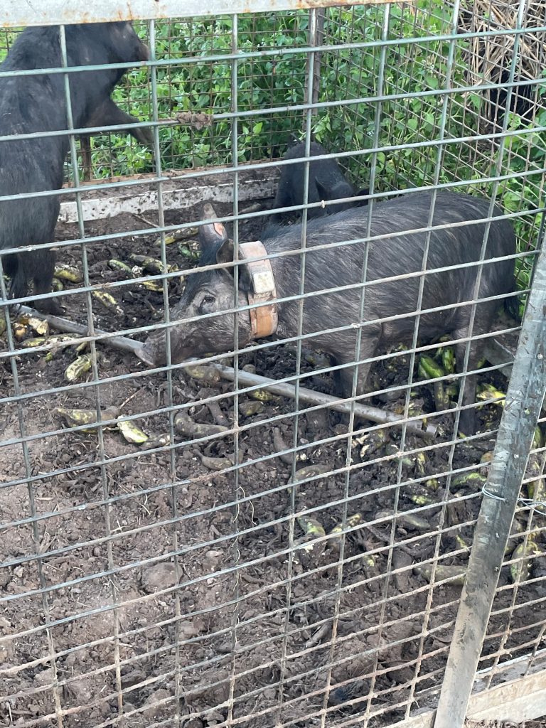
GPS tracking collars were deployed on female “Judas” pigs to better understand movement patterns and habitat use. Tracking data provided new insights into feral pig behaviour within the Herbert district.
Results showed that most collared pigs used smaller home ranges than expected, with female pigs occupying areas of approximately 5 km², and one individual remaining within roughly 150 hectares. Males travelled further than females, but still showed predictable movement patterns.
Tracking data also indicated that pigs causing damage to sugarcane often lived within 2 km of affected blocks, frequently operating in overlapping family groups. This finding suggests that localised control efforts can be effective when targeting pigs close to damaged areas.
Some pigs avoided cane areas, while others repeatedly used specific blocks or varieties, demonstrating that pig behaviour can be highly predictable once movement patterns are understood.
These insights allow control programs to:
- Target high-use areas
- Improve trap placement
- Increase control efficiency
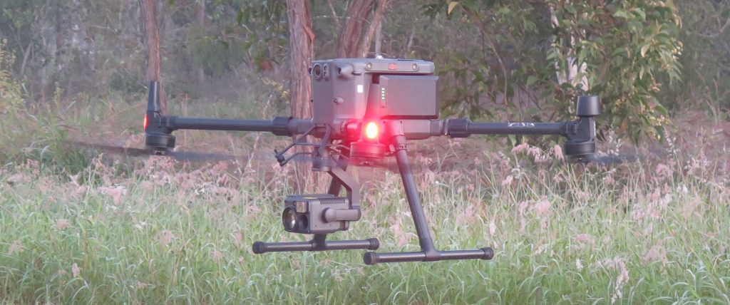
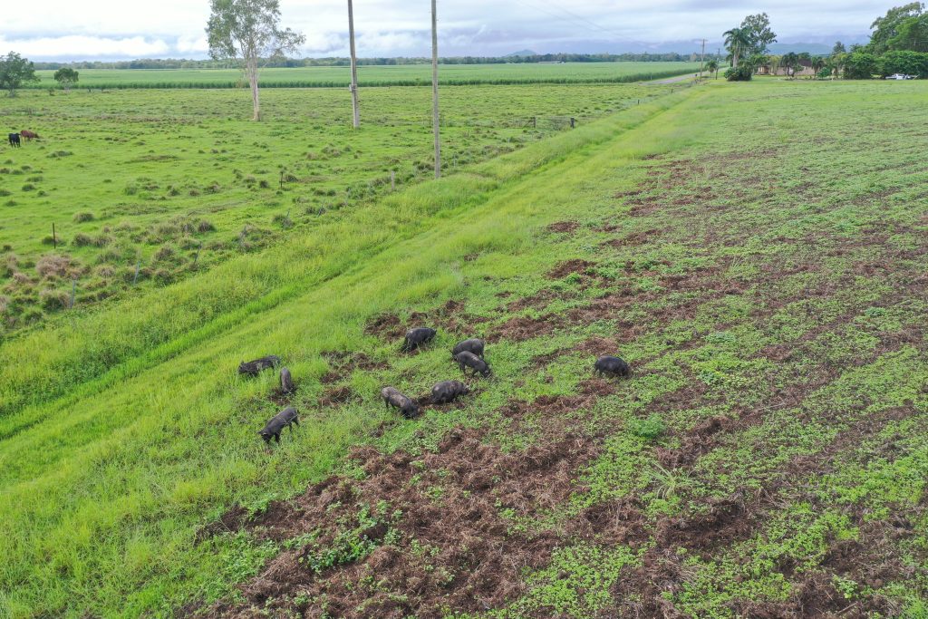
Drone-Based Thermal Imaging Surveys
Project Squealer assessed drones equipped with thermal imaging cameras for detecting feral pigs. Thermal drone surveys allowed pigs to be located in dense vegetation, fallow ground, and flooded areas where ground access was difficult.
Thermal cameras assisted with counting mob size and identifying pig locations, providing landholders with improved information for planning baiting and trapping operations.
Drone-based surveys provided several advantages:
- Detection in dense vegetation
- Access to flooded areas
- Rapid survey of large areas
- Identification of mobs for targeted control
Thermal imaging proved particularly useful for locating pigs prior to control activities and improving targeting efficiency.

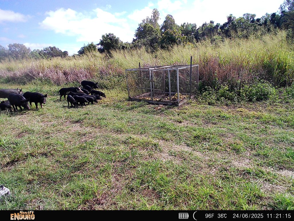
Drone-Based Bait Delivery
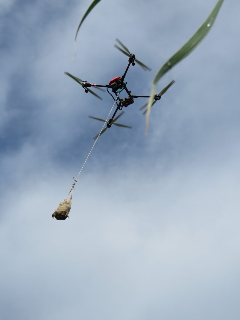
The project also investigated using drones to deploy pre-feed and poisoned baits in areas inaccessible during the wet season. Drone baiting successfully demonstrated the ability to place baits in remote or flooded locations.
However, operational costs were significant. Equipment purchase, training, licensing, and monitoring requirements meant individual baiting operations could cost thousands of dollars. The assessment concluded that, while technically feasible, drone baiting may not always be the most cost-effective control method.
Despite the cost, drone bait delivery may still be valuable in:
- Inaccessible cane blocks during wet season conditions
- Remote coastal wetlands
- Areas unsuitable for ground baiting
Wet Season Feral Pig Behaviour
Understanding wet season pig behaviour was a major focus of Project Squealer. GPS tracking showed no significant change to their movements during the wet season, regardless of flooding, as compared to the dry season.
Movement data suggested pigs damaging cane were typically local residents rather than transient populations. This improves confidence that local control programs can effectively reduce damage.
Wet season tracking also helped identify:
- Feeding locations
- Trap placement opportunities
Automated Trap Technology
Project Squealer also explored the use of artificial intelligence to automate trap gate closures. This technology aims to detect pigs entering traps and trigger gate closure automatically.
Potential benefits include:
- Reduced non-target captures
- Remote monitoring capability
- Reduced labour requirements
- Increased efficiency of trapping programs
This technology remains under development but shows potential for integration into coordinated feral pig management programs
Project Outcomes
Project Squealer demonstrated that emerging technologies can improve feral pig management, particularly when integrated into coordinated control programs.
Key findings included:
- GPS collars revealed smaller-than-expected home ranges
- Pigs damaging cane typically lived within 2 km of affected areas
- Thermal drones improved pig detection and population counts
- Drone bait delivery was feasible but expensive
- Pig behaviour showed predictable patterns
- Targeted control can improve efficiency
These findings support more strategic and cost-effective feral pig control across the Herbert region.
Future Applications
The technologies evaluated in Project Squealer have potential for broader use across North Queensland. Combining GPS tracking, thermal drones, and targeted control strategies can improve monitoring, planning, and operational efficiency.
These tools support:
- Landscape-scale pig management
- Improved targeting of control operations
- Better understanding of pig behaviour
- Improved return on investment
Project Squealer has demonstrated that GPS tracking and drone technology can play an important role in modern feral pig management, particularly in regions affected by wet season flooding and limited access.


